Stream temperature is an important water quality attribute in many of California’s streams, especially those that support cold-water fisheries such as trout, steelhead, and salmon. Several fish have been identified as threatened or endangered, and elevation of summer stream temperatures is often cited as a cause. Activities such as streamflow diversion for irrigation of pastures, return of warm irrigation runoff to streams, and reduction in riparian canopy cover due to logging and grazing can increase stream temperatures. We are actively investigating the factors which control stream temperature and how management may, or may not, influence these factors on rangeland watersheds.
Project 1: Analysis and Interpretation of Stream Temperature Response to Watershed, Stream Reach, and Riparian Factors
Participants – Yukako Sado, Don Lancaster, David Lile, Marni Proath, Julie Laird
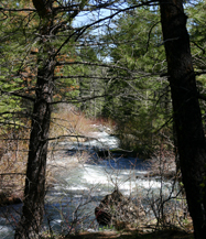
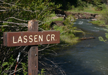
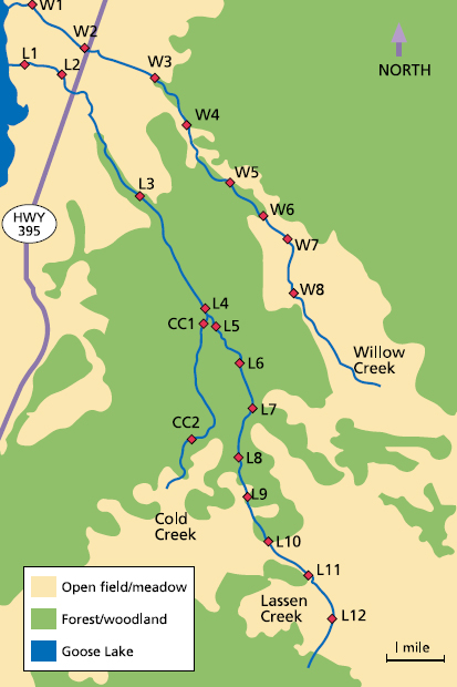
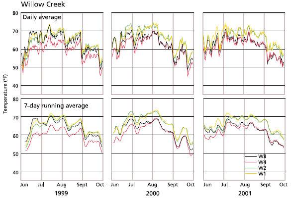
The objective of this project was to provide guidance and explicit examples of how to graphically and statistically analyze and interpret watershed scale stream temperature data. We utilize a comprehensive dataset of stream temperature, air temperature, streamflow, streamside vegetative canopy, and solar input collected during the summers of 1999-2001 across the Lassen and Willow Creek watersheds in northeastern CA.

In the first paper from this project, we have demonstrated some display and graphical analysis approaches by which data collected in typical stream temperature monitoring projects can be interpreted by and presented to land managers, watershed groups, and other interested parties.
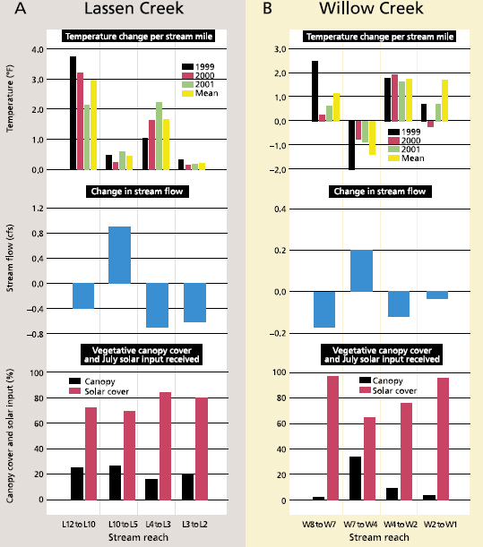
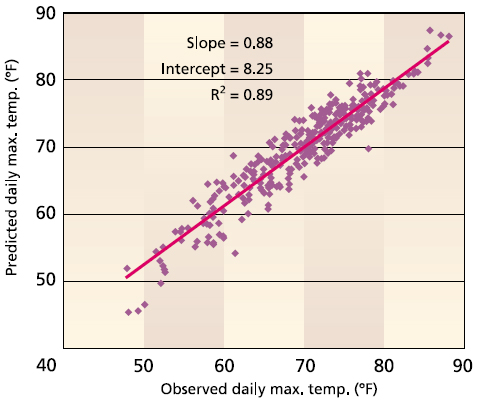
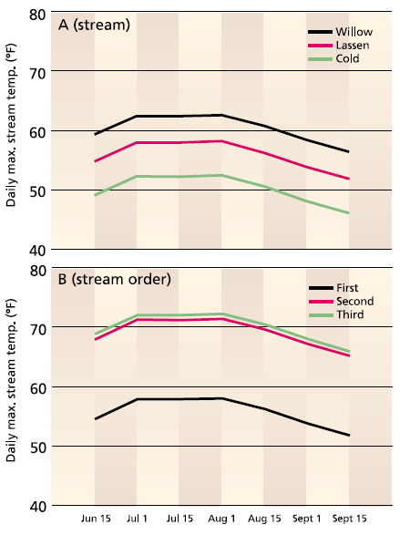
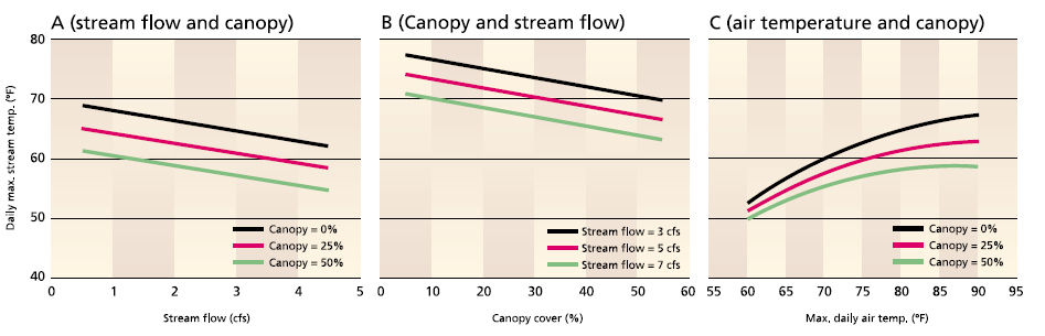
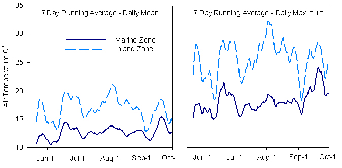
Figure 1
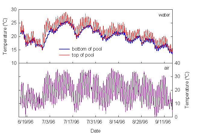
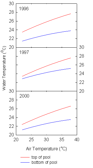
Figure 2

Air temperature was lower in the marine influenced zone of the watershed compared to the inland zone.
The maximum elevation of marine intrusion was about 600 ft above mean sea level, making roughly 30% of the watershed “marine zone” and the remainder “inland zone”. Streamflow was greater in the mainstem Garcia River than in tributaries and declined rapidly as summer progressed.

Stream temperatures were consistently warmer in the inland zone of the watershed compared to marine air influenced zone at both the tributary and mainstem scales.
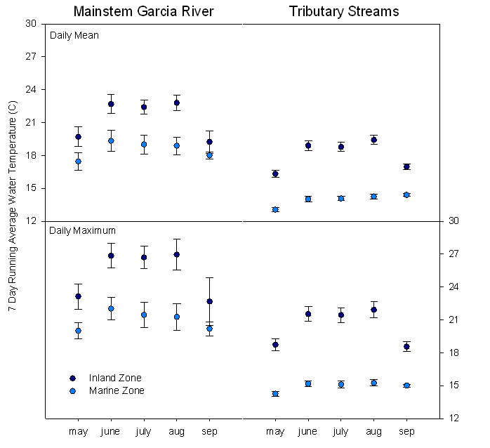
Tributary streams were cooler than the mainstem Garcia River, and there was greater variation in temperature between mainstem sites. There were significant relationships between water temperature, air temperature, stream order, marine intrusion zone, and stream canopy cover (P<0.05). There was an interaction between marine intrusion zone (marine v. inland) and stream canopy cover.
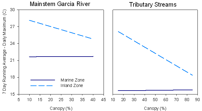
Basically, stream temperature decreased with increasing stream canopy in the inland zone – for both tributaries and the mainstem. However, there was no reduction in stream temperature with increasing canopy in the marine zone. Regular overcast conditions significantly reduced solar load in this portion of the watershed. The analysis simultaneously considered air temperature and marine zone, so cooler air temperatures in the marine zone do not account for this differential response of water temperature to canopy cover.